Science

KoBold turns exploration
into a repeatable science

KoBold prediction cycle

KoBold tech is a system of innovations that work together to revolutionize discovery.

New Sensors Collect Better Data

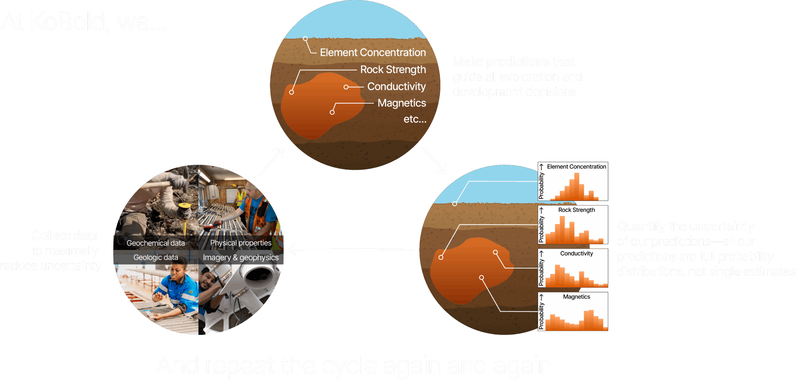
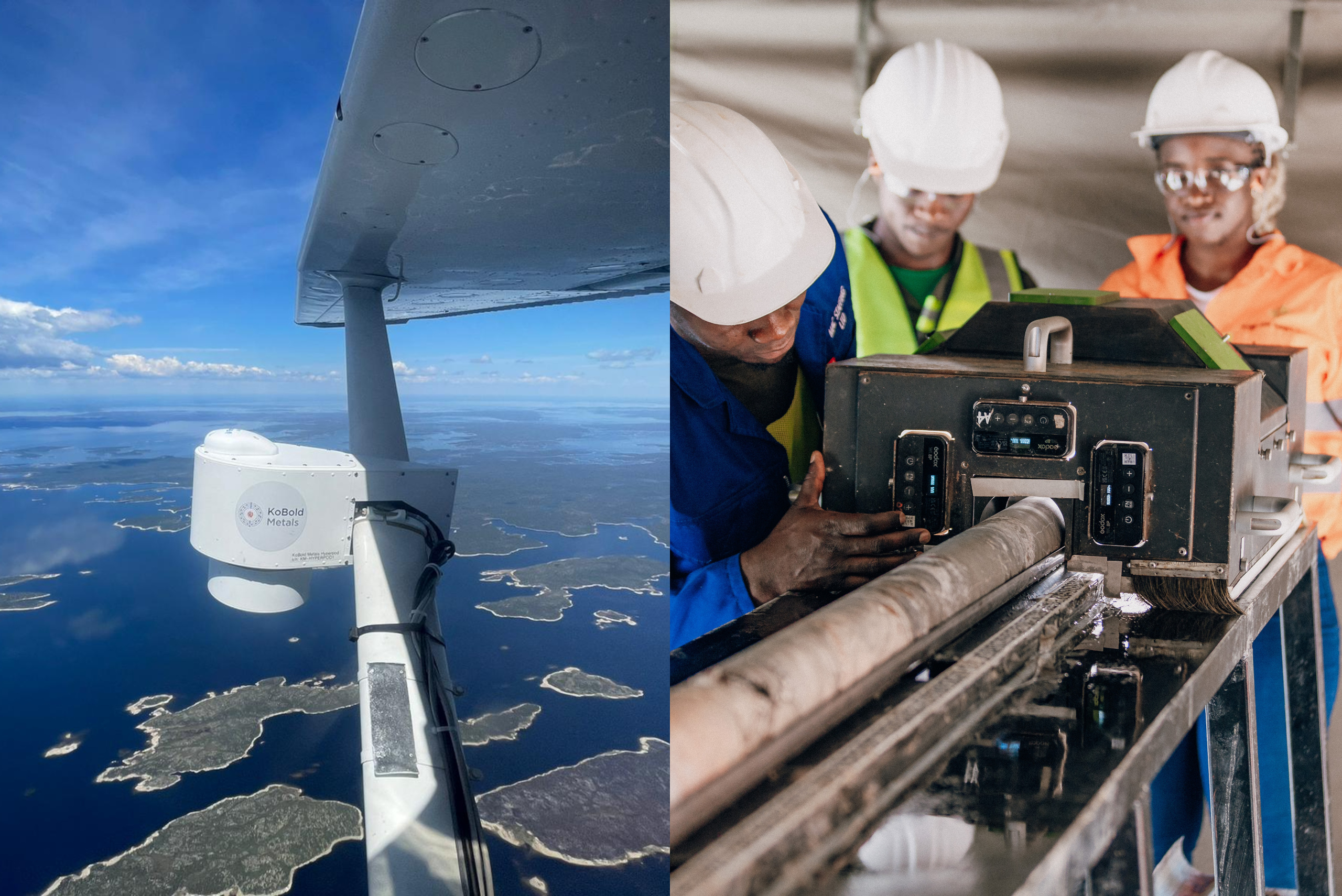
Our team built and deploys the Hyperpod around the world, collecting RGB, hyperspectral, and LiDAR data 10X faster than the industry with higher resolution than commercial satellites. KoBold’s Korecam360 takes 360-degree core photos at the rig, before the core is broken or moved. These are just two examples of new sensors we develop and innovate to capture higher-quality data at lower cost, from the air, the surface, and deep underground.

A System That Organizes the World’s Geoscience Data

Our data system organizes everything we know about the Earth’s crust from many disparate data sources and data types—reports, legacy maps, handwritten notes, geophysical and geochemical data—standardized, searchable, across any language.

Predictive Models Inform Better Decisions

Our models make all sorts of predictions that are continually refined from new training data collected by geologists in the field. From resource definition (e.g., grade, thickness) to geological (e.g., rock type, lithology) to physical properties (e.g., conductivity, magnetic susceptibility), our predictions come with uncertainty. So we can make the best exploration and development decisions.

The Impact

Turning exploration from a slow, manual process into a fast, data-driven repeatable science

Team

Geologists.
Data scientists.
Engineers.
Different disciplines.
Shared purpose.

At KoBold, we work together on the same challenges, with shared goals. That’s where the magic happens – and it’s our greatest advantage.

Contact our business development team to schedule a technology demo